Plenty of people have 'crossed' the Alps in plenty of different
ways: Hannibal, Napoleon, Steve, and about a zillion billion others – including the
Von Trapp family, of course. Some have been invited to pop over to a neighbouring state as guests while some
haven’t, and others have simply been in a hurry to get away from someone nasty. There’s the easy way - the Mont
Blanc tunnel, in the pen-making region of the Alps where nibs grow wild on
trees up on high. The tunnel is great for cars but not so handy for bikes. There
is the Brenner Pass – this involves busy roads and is the long way around and I did that in a bus when I were a nipper. There is also the Col de La Bonnette, the French Alps' highest point. - myself
and my cycling buddy, D, have already ticked that box – likewise the Grand St.
Bernard Pass, and its partnet le Petite version just south of Mont Blanc.
There are routes further east to consider, one of which is the Bavaria-Milan route through Austria and Italy. This route features two engineering feats – the Rechen Pass and the truly gobsmacking hairpins of the Stelvio Pass and, so, this was is the summer’s big trip.
There are routes further east to consider, one of which is the Bavaria-Milan route through Austria and Italy. This route features two engineering feats – the Rechen Pass and the truly gobsmacking hairpins of the Stelvio Pass and, so, this was is the summer’s big trip.
Due to time constraints, D and I had to cut the Bavarian
Overture by starting at Mittenwald, a five-minute walk from the Austrian border
– more or less.
The two nearest
non-Alps airports are Munich and Milan (Linate and Malpensa). BA in advance cost £145, into Munich and out of
Linate, from/to T5 at Heathrow.
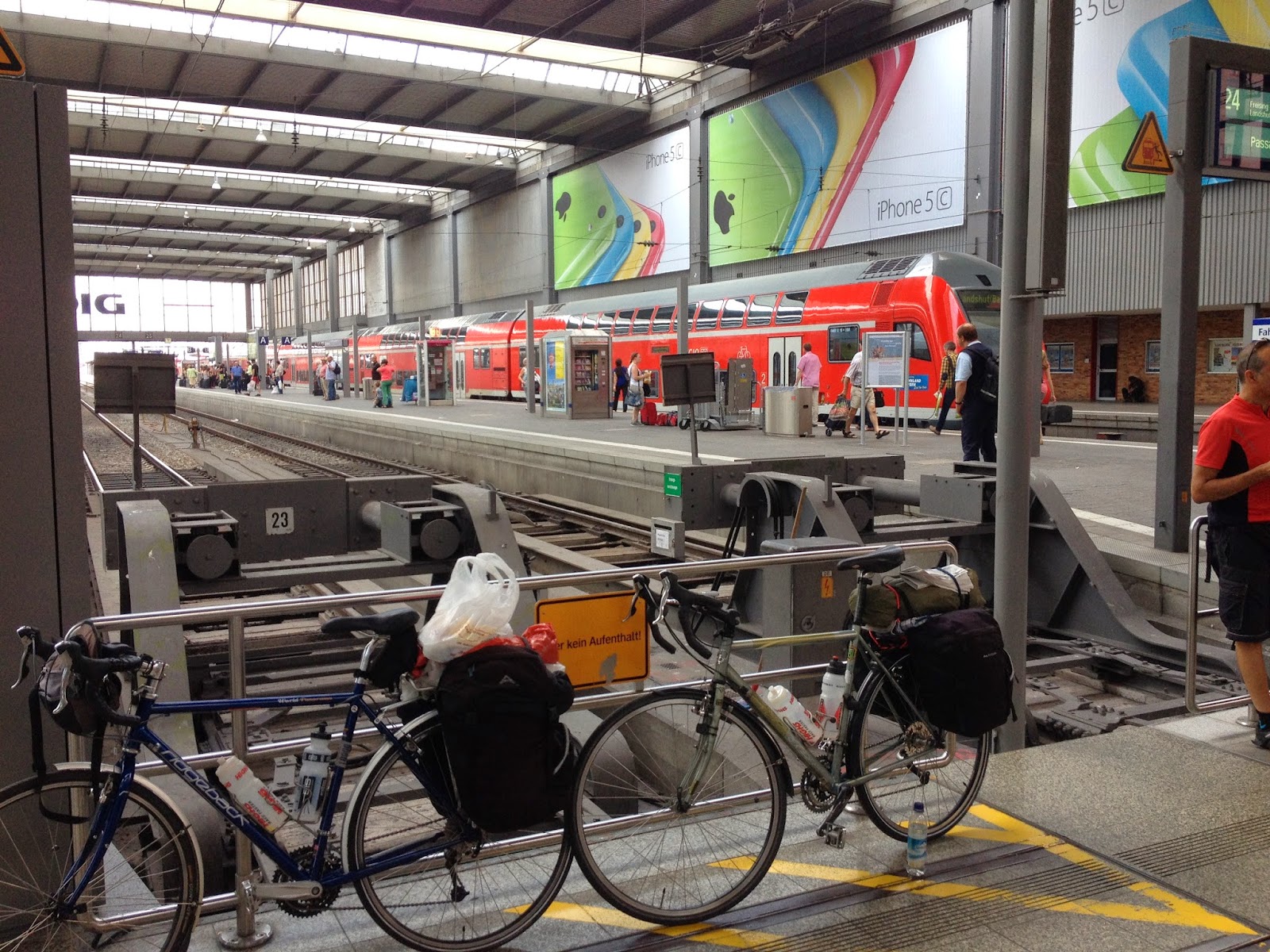
Bike-in-a-Bag on Planes.
I have only used BA and have no complaints. My advice is to get early flights - this also benefits the time spent cycling - as airports are not so busy, and get there 3 hours before the flight if using the funtastic bike-in-bag method:
Find a quiet space. Untighten and turn handlebars 90 degrees, then turn them downwards so that the bar end comes up around the 'cross bar'. This will give some protection to the brake/gear levers.
Lower seat, take off pedals - unitghten and retighten the day before so as to check they will come off to avoid embarrassment.
Deflate tyres half way.
Leave a pannier containing a light and bulky, soft item on the back rack on the derailleur's side to give it protection.
Slip into the bike bag and tape up neatly using packing tape AND Fragile tape.
Make sure anything that can remotely be considered a dangerous item goes in the hold: ALL tools, stove, lighter, cutlery set, penknife, tent pegs, lights ('Whatthisforthen?') etc. If you have anything dodgy on you at security you'll have to check it in as an extra bag at a cost of 35 quid or more. Best just take a pannier of clothes, wallet, electronics and passport with you into cabin.
Get to front of queue and smile and make out you do this everyday!
Deposit bike at bulky items and say bye-bye.
On reassembly after flight: Do not rush the pedals - make sure the thread is aligned and do not go mad inflating tyres too fast. Check derailleur, brakes and all other vulnerable externals. CHECK wheels aren't loose!
Do the return using as late a flight as possible - and make the most of your final day's cycling. I always try to keep a clean t-shirt put aside for the flight home.
Mappage
IGN and the Ordnance survey do a pretty good job map-wise and incorporate all kinds of useful information in their maps - like pubs, stone circles and gun emplacements. They also show road numbers and distinguish motorways from farm lanes. However neither of those brands cover the route. The 1:150000 Michelin and Freytag and Berndt are handy for carrying but, when push came to shoving our bikes up paths that didn't actually exist, and discovering what looked like a quiet country road on the map is actually a dual carriageway, both maps were not up to the job. Carrying shelf loads of 1:25000 scale maps is impractical. Have no advice on this other than that mobile broadband is getting cheaper to use abroad.
Weather
This was not looking good. GFS and its animated forecast, XC and Accuweather were the online crystal weather balls I peered into. In the end, XC was pretty much spot on - even four days ahead.
And so, with no further ado, we start with touching down at Munchin Flughafen...
Munich Airport to Bahnoff
Trains run every 15 minutes to the Central Station, with a journey time of nearly an hour. As the fields drifted by, mile after mile, my first thought was that they could have built Munich a bit nearer the airport. Tickets are obtainable from desks within the airport. Buy a Welderfeld ticket for two people at €25 plus €10 for the bikes (July 2014). These will let you travel within Bavaria for one day – but not on the fast intercity services. Services can be found in English at the handy DBahn website. Unlike Italian and French, train the bikes can be wheeled into carriages without having to clamber up steep vestibule steps in a most undignified fashion.
Train to Mittenwald
These are fairly frequent from the central station but may require a change at Garmisch. You could start your journey there but the road south looks potentially busy and while Fusen is also a starting point further west, the route south is reportedly ropey for bikes in places. Google Maps, as of July 2014, does not have Google streetview for Germany or Austria and so, erring on the side of caution, we chose Mittenwald as there was a B-road route that looked potentially OK.
Unlike France and Italy you don't have to self-punch your ticket in a self-punching machine prior to boarding. The bike carriage has space for three or four hanging bikes, or you can leave them as is if the carriage is empty.
The train was full of polite lads, brimming with youthful zest and vigour. They sat at their table seats playing wholesome card games while listening to Bavarian accordion music on a Beats Audio sound system. I cannot imagine the same scene in the UK, with similar looking chaps huddled around a device emitting some Morris Dancing music or Terry Wogan’s timeless rendition of the Floral Dance. While we felt ourselves beginning to slap our thighs in time to the stirring accordion riffs, we enjoyed great views of the sub Alps offered by the train.

Mittenwald to Stams
There are stores that sell stove gas in the Mittenwald – and food shops - but not much beyond that before you get to Telfs. A young man wearing a bark-green felt alpine hat with a headband decorated with a feather and one of those alpine jackets rode by with youthful vigour on a bicycle.
The turn onto the L14 for Leutasch was very easy to find – an abrupt right and you are right into a hill - though quite a mild gradient.


The weather was perfect for this fantastic valley ride along quiet, picturesque roads followed by a great descent into Telfs to pick up the Inntalradweg (Innradweg) by taking a shimmy under the railway line and over the river.

The Innradweg is a tarmac path that follows the River Inn from Switzerland to the Danube. The path’s signage is a bit flaky at times, turning up here and there, flirting with you then disappearing - and so we used the road to get to Stams. Eichenwald campsite is up the hill, past the extraordinary Meinhardinum Gymnasium undAufbaugymnasium.


As mentioned, the Innradweg is not always clearly signposted. Be careful to avoid any path OTHER than Innradweg unless you know what the path is up to! Beware of Jacobsweg and yellow path signs as these are often difficult footpaths and more suited for hardy mountain bikes.

A rather unlikely scene followed and overtook us on the road beside the path. This was a convoy of WW2 vehicles (German ones) and men bedecked in spooky looking uniforms and so, for one brief moment, we wondered if some drastic political event had occurred overnight.


The path winds through narrow gorges, often beside a railway and frequently crosses the Inn only to cross back so you are not necessarily lost. There are some short steep uphill bits but it is largely a great ride with up a very gradual incline. Not a lot in the way of shops on the path but there are plenty of cafe/bars.

 Up and till we ‘mislaid’ the Innradweg the going was good and the weather just about hung in there. At Imst Pitztal the path crosses the river on a bridge that begs to be crossed. I thought – as my map suggested – that the path continued on the south bank. It did so, it seemed, but only for a few hundred metres at which point it deteriorated into a steepening footpath with an indeterminate surface and so became less fancy-touring-bike friendly. The view across the valley to the right side of the tracks was teasing - jolly families cycling along the smooth tarmac of the proper path while vigorously singing wholesome Alpine ditties Von Trapp-style. The fact that we had to dismantle a gate then lug the bikes over a fence also suggested that the path was not a bike ‘weg’. Trying to get back onto the Innradweg proved difficult and in all we lost an hour or so thanks to poor mappage.
The Innradweg joins the Via Claudia Augusta at Imst or thereabouts. This is a route across the Alps that follows the valley of the Fiume Adige to Merano and onto Bolzano. For the time being it shared the Inn valley.
All in all this was enjoyable and easy cycling with great views and the powerful Inn river to keep the eyes occupied. This kind of riding gets the legs in gear for tougher days

Unfortunately, the weather caved in the late morning and meant a damp journey from Zams down to Pfunds (pronounced foonts). I had booked a couple of rooms at the olde worlde Pension Grein on the west bank. Good clean rooms at €35 including breakfast. The friendly and enthusiastic staff were happy to serve us very competitively priced wholesome beer that we consumed with vigour to slake a thirst that had burgeoned through the afternoon.


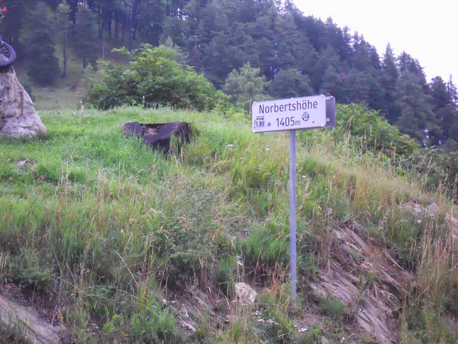
The seven mile ride up the Inn to Martina on the Swiss border is a good warm up for the Norbertshohe, a climb that clings to the steep wooded valley to go over to Nauders.
 |
| Bridge over the River Inn |
 |
| Norbet Schwarzenegger? |

You also pass into what the world calls Italy but is a sore point in them thar hills. Given the state of Europe at the moment, it could also be a slow ticking time-bomb. South Tyrol, as the area calls itself, speaks German as this wee bit of Italy was annexed from Austria in 1917 and the inhabitants are carrying on the tradition of not being too pleased about it.

This is a beautiful ride and not a tough climb. The path gets a bit weird and hard to follow on the east side of Laggio de Resia and its sunken village.

After an unspectacular dam, the path heads over to the west side of the smaller lake and, once past the end, though not steep, the ride turns into a unbelievably superb, blood curdling, adrenalin-hungry descent. The heart and everything else was in the mouth. The well-maintained, smooth surfaced path does have cars and is only single lane - keep your eyes open be careful. The quaint village of Burgusio appears very sharply to signal the end of this fantastic roller-coaster of a ride.


After Mals you have to take a B road to Glurns before continuing on the Via Claudio Augusta path to follow the valley eastwards. Instead we took and a right-then-left shimmy onto the SP50 to Prato Allo before hanging another left onto the legendary SS38, better known as the Strada del Passo dello Stelvio.
 |
| The sign we were waiting for |
 |
| Gomagoi and some well earned butterkeks |

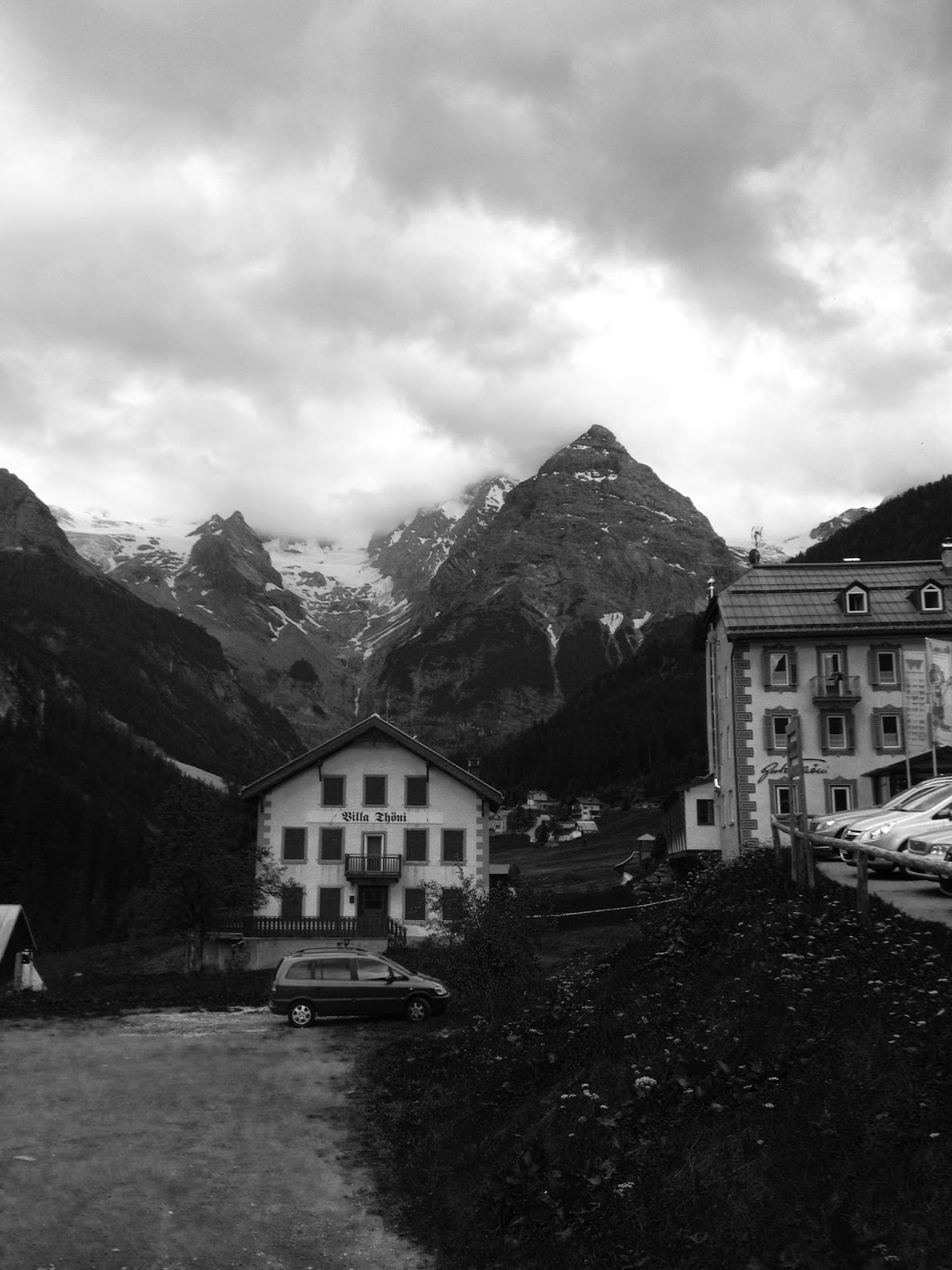
The 25km climb starts in Prato and the road is quite busy though big trucks are banned. Once you get past Prato Allo there is not much in the way of shoppage and none at all in Trafoi. There is a nice cafe at Gomagoi and a couple of Pensions.
It is a breathtaking steady ascent to Trafoi, without much beyond 8% until you reach the first of the famous hairpins - Bend 47, where you get a taster for the stuff ahead. Having done a fair old wack during the day we’d pre-booked a night’s stay in the village. Trafoi’s five or six hotels are on Bends 46 and 45 with the spectacular vista of the mountains of Tuckettspitze, Trafoier Eiswand and Thurwieserspitz across the valley.

The Hotel Post is lovely hotel – nice rooms and a good, no-frills restaurant and family run by the very helpful Francesca – who let us make sandwiches at breakfast prior to the second part of the climb.


 The days of me completing a 25k climb with a loaded bike are slipping into the grey sands of time on a grey beach under a grey sky. It is not that I don’t feel capable physically – it is the mind over matter challenge of maintaining a healthy interest in a three or four hour climb. I set this up so that we would split the climb into the easy and hard parts. With any climb the descent cannot be taken for granted as it will possesses completely different dangers to the ones faced on the ascent and all faced at nearly ten times the speed. So I wanted to be going up – then down - the Stelvio early on a weekday – less traffic, muscles recovered from the previous day's jollies and, usually, a cooler temperature. The weather provided a short window of opportunity in the swathe of rain that had covered the trip: 8am – noon would be rain-free and sunny.


Down the other side. There was all kinds of preparation on the acme of the hill for those heading down. The customary newspaper down the shirt plus gloves, tights...It gets cold going downhill. Also, eat and drink as you don't want anything seizing up at the wrong time. Finally, check everything is attached to the bike as it should be - especially the panniers as they will jump at the chance to bounce about and fall off.
And the off: after a sweeping bend we came to a stack of hairpins and then the feature I dreaded the most – six tunnels in quick succession. Fortunately, traffic was thin on the ground, which was just as well considering the quality of the road surface lurking within the dank darkness.


 |
| one down, 46 to go |
It is a breathtaking steady ascent to Trafoi, without much beyond 8% until you reach the first of the famous hairpins - Bend 47, where you get a taster for the stuff ahead. Having done a fair old wack during the day we’d pre-booked a night’s stay in the village. Trafoi’s five or six hotels are on Bends 46 and 45 with the spectacular vista of the mountains of Tuckettspitze, Trafoier Eiswand and Thurwieserspitz across the valley.
The Hotel Post is lovely hotel – nice rooms and a good, no-frills restaurant and family run by the very helpful Francesca – who let us make sandwiches at breakfast prior to the second part of the climb.
Trafoi to Bormio.
The days of me completing a 25k climb with a loaded bike are slipping into the grey sands of time on a grey beach under a grey sky. It is not that I don’t feel capable physically – it is the mind over matter challenge of maintaining a healthy interest in a three or four hour climb. I set this up so that we would split the climb into the easy and hard parts. With any climb the descent cannot be taken for granted as it will possesses completely different dangers to the ones faced on the ascent and all faced at nearly ten times the speed. So I wanted to be going up – then down - the Stelvio early on a weekday – less traffic, muscles recovered from the previous day's jollies and, usually, a cooler temperature. The weather provided a short window of opportunity in the swathe of rain that had covered the trip: 8am – noon would be rain-free and sunny.The Stelvio Pass is tough but not difficult – if there is a difference.
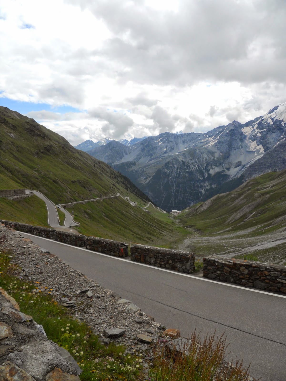
The first section beyond Trafoi consists of long stretches between the occasional hair-pin. Then, all of a sudden and as if by magic, there is a cluster of steep bends before another period of long stretches takes you to Bend 32 when they come thick and fast.
The first section beyond Trafoi consists of long stretches between the occasional hair-pin. Then, all of a sudden and as if by magic, there is a cluster of steep bends before another period of long stretches takes you to Bend 32 when they come thick and fast.
At Bend 22 – by a hotel and its cafe - you are faced with the wall rising above you at the head of the valley and the remaining 21 bends - the business end of the climb – but the 10%+ ‘ramps’ are quite short and for most part the elevation hovers around 10%. There are occasional markers with the elevation and distance that reassure you that the going is not likely to get any worse.
The road was built in the early 19th century by Carlo Donegani, who obviously had nothing better to do than traipse about the Alps checking out good spots for such a road. It formed part of the Hapsburg’s European domination that terminated with WW1 when the aforementioned region was annexed to Italy. The Austrians cannot complain too much what with all the annexing they’d been up to in Italy during their empire days.
Starting at 8.30am on a Monday, the first hour on the Stelvio was quite quiet but towards mid-morning the growl of baritone motorbikes filled the valley from above and below and soon after boy-racers could be heard screaming up the SS38.
There is plenty of space at each bend and time to see things coming – especially the scheduled bus. Just keep your ears and eyes wide open and be careful as you pull out on right-handers to make the camber as a stealthy, descending cyclist may be hurtling down around the corner.
We encountered a lad from Nottingham who'd had a blow-out and crash coming down. All shook up from the crash, he was still shaking as he tried pulling himself together on the gravelled space on the cusp of a bend. With a couple of scars and a trashed derailleur, we flagged down a passing car who could give him a lift to the top.
Every twist and turn provides a breathtaking view of the gathering valley below. Glaciers hang precariously between the three peaks. The views and the short stages - each with their end in sight makes the Stelvio easier to bear than, say, Ventoux with its relentless journey through a dull forest and no respite before it gets to the moonscape.
At the top the final bend resembles Kao San Rd in Bangkok – albeit with German and Italian flavours – with several shops selling Stelvio merchandise – shirts, t-shirts, teddy bears, duvet covers, lampshades, three piece lounge suits (awkward to get on the bike) etc. As one vendor tried persuading me about the garish shirt she offered me – ‘not made in China, made in Italy’, I, instead, bought my garishly coloured exclusive shirt from chap a few stalls on who offered me the bonus of a pair of socks all for €55 – he saw me coming. Well - whatever.
Down the other side. There was all kinds of preparation on the acme of the hill for those heading down. The customary newspaper down the shirt plus gloves, tights...It gets cold going downhill. Also, eat and drink as you don't want anything seizing up at the wrong time. Finally, check everything is attached to the bike as it should be - especially the panniers as they will jump at the chance to bounce about and fall off.
And the off: after a sweeping bend we came to a stack of hairpins and then the feature I dreaded the most – six tunnels in quick succession. Fortunately, traffic was thin on the ground, which was just as well considering the quality of the road surface lurking within the dank darkness.
Out of those and D got a puncture – the unthinkable that we had already seen the consequences of on the way up. D’s flat, thankfully, wasn’t a blow out. As he did the needful the weather changed very quickly and I saw monstrous rain-packed clouds moving up the valley. I took refuge in a seventh tunnel as the deluge poured down from the sky. Once the rain had passed we sped down to Bormio and beyond. There is a road that flanks the autostrada and gets you to Tirano safely and provides more fantastic views.
It was 4pm by the time we got to Tirano and we needed to be in Colico on Como and so I’d planned that we’d avail ourselves of the train. This cost us €17 for the hour long journey down what became the usual low Alp valley – busy and crammed with villages and ugly industrial areas. The weather caved in once more and though we were spared another deluge as we put our tents up, as soon as we returned from the restaurant the weather turned it up again. The weather was appalling. At the campsite we met four brothers were cycling from Eindhoven to Rome – a popular route for the Dutch as they were the second group we'd met on that mission. A Dutchman has written an inch-by-inch book about the route – a best seller in Holland they said.
 |
| Como |
Colico to Trezzo sul D’Adda
The heavy rain continued on into the morning and so we decided to take the train again – on to Lecco and the start of the D’Addo cycle path.

My concern about my lack of attention to the route for getting to Linate airport was growing and so the nearer we got to the airport by the evening, the better. The cycle path starts on the east bank and eventually becomes quite isolated as it hugs the bank while the road and civilisation stay high up on plateaus either side of the gorge. The rain had turned the chalky gravel path into a skidding mud-clinging experience and not the conditions for the fancy-dan touring bikes.

We washed the excess mud off the bikes at a slipway and left the D’Addo to engage with Italian traffic and the maze of roads down to Trezzo sul D’Addo. There are some impressive bridges over the D’Adda – especially the Ponte D’Adda and those in Trezzo itself. The afternoon dragged on and yet again the weather caved in. Torrential rain and electrical storms (as opposed to clockwork) put paid to any idea of setting up camp anywhere. We bottled it and ended up in Trezzo’s 4* Best Western. At €85 each inc breakfast and some nice complimentary toiletries, this dented the budget. In no time the rooms were covered in wet tents and honking damp clothing. Found a great pizza takeaway before luxuriating in the hotel bed.
 |
| Ponte D'Adda |
 |
  Trezzo sul D'Adda Trezzo sul D'Adda |

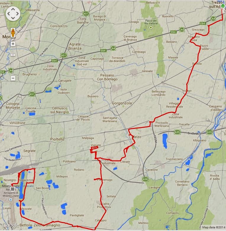
Trezzo to Linate
I could not find a decent way to get to the airport. Until the metro is completed, trains don’t go there and it is surrounded by dual or triple carriageways. A new Autostrada is being built between Bergamo and Milan and my already useless map was rendered even more useless as the new road sliced our cycling roads in two. Even google maps on the hand-helds was struggling to keep up with the construction work. Again, the rain came but not as heavily as we struggled with dead-ends and deadly hard-shoulders as huge trucks rumbled by. The Michelin map 150,000 was, by now, a meaningless random bunch of squiggles as busy main roads were drawn as ‘white roads’.
If you are heading in from the D'Adda or Bergamo, I would suggest a train to Seagrate then navigate your way to the airport on the big roads using the cycle lanes that were being built at the time we were there. Just as you are within spitting distance, you just have to bolt down to Linate along the Via Circonviallazione Idroscalo. If coming from the south get onto the SP15b - which will also lead to the Via Circonviallazione Idroscalo route. Malapensa could be a much better choice altogether though flights were heading to Gatwick and it is a good distance north west of Milan.
Thankfully, and as always, I build in plenty of time for the escapade of getting to an airport: arrive one hour before check-in starts and add an hour to that, just in case, then, as a precaution, add an hour. In this case, all the dead-ends, retracing and detours cost us those two extra hours.
Thankfully, and as always, I build in plenty of time for the escapade of getting to an airport: arrive one hour before check-in starts and add an hour to that, just in case, then, as a precaution, add an hour. In this case, all the dead-ends, retracing and detours cost us those two extra hours.

Epilogue
Traffic.
Having cycled for the best part of 100 miles in Italy, my very limited experience is not one of lunatic drivers. There were 4 nutters we came across on the Italian roads: one politely said ‘sorry’ after I called him and effing so-and-so following his dicey manoeuvre while the other three had UK plates and were behaving like children/Jeremy Clarkson on the Stelvio. On most other occasions, traffic gave us a wide berth or waited patiently behind us. The thing is that the roads were all choc-a-bloc for no apparent reason other than they were choc-a-bloc – permanently busy and especially with big trucks. So you have to stay alert, which makes for very intense cycling. Bike lanes were good in places and then vanished. They tended to run parallel to the roads rather than occupy the hard shoulder – but maybe this is just the way in Lombardy.
The Stelvio is well worth the journey - especially if you have utilised the Innradweg and Via Claudio Augusta paths. The big climb - from the north is not the hardest in the world - but it is certainly an eyeball pleaser.